Boardwalk or Open Path: Choosing a Coastal Route
Boardwalk or open path? Compare route continuity, crossings, and upkeep to choose a coastal approach that supports public access and fits the site.
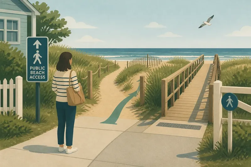
The most common mistake in comparing a boardwalk or open path is choosing by appearance before checking how the route meets streets, buildings, and the beach. A beautiful approach can still leave a confusing gap at either end, costing visitors confidence and making public access harder to use.
Start with the connections
A coastal route is not just its central stretch. It links an arrival point—perhaps a sidewalk, parking area, or transit stop—to the shore, and it may pass gates, paths, or other shared spaces along the way. Each connection shapes whether someone can recognize where to go and continue without having to guess.
A boardwalk can make a crossing over soft or irregular ground explicit, but its ramps, turns, and transitions need to connect to the paths around it. An open path may blend neatly into a neighborhood walk, yet an indistinct entrance can leave newcomers unsure where public access begins. Neither form settles questions about ownership, permission, or the public status of land; those need confirmation from the relevant local authority.
Before selecting a surface, draw the full route on a town map. Mark where it begins, every crossing or turn, and the point where it meets the beach or another public space. This simple map shifts attention from a feature in isolation to the route people must actually follow.
Entrances and thresholds
At the inland end, a route should announce itself without requiring visitors to interpret a private driveway or pass through a space that appears restricted. Signs can identify the public approach, while a visible, continuous path helps carry that information forward. At the shore end, the design should make clear where the maintained route stops and what surface comes next.
These thresholds deserve the same care as the main path. A boardwalk that ends abruptly above loose sand may offer no obvious way to continue. A ground-level path that fades into beach grass can make its public endpoint hard to identify. The design team should show the transition in plan and on site, including how visitors with different mobility needs can approach it.
Say a fictional town has a sidewalk ending beside a dune path, with no sign and two similar-looking openings. Its committee maps the public approach, asks the planning office to confirm which opening is the public route, and proposes a clear sign at the sidewalk with a continuous surface beyond it. The expected result is that a first-time visitor can identify the correct entrance before reaching the dune edge; if local review shows the sign would direct people across private land, the town would instead revise the route and its map.
Route continuity
Visitors often encounter small breaks that drawings can conceal: a curb, a narrow gate, a sharp turn, a change in surface, or a place where the route crosses vehicle traffic. Treat each as part of the public route, not as a separate detail to resolve later. A continuous line should be understandable from arrival to shore, with transitions that do not force people to improvise.
Compare the designs by tracing a journey on the ground or on a detailed plan. Where does someone stop? Can two visitors pass without leaving the intended route? Is there a clear choice at every fork? A raised structure may organize movement through a sensitive or uneven area, while a path at ground level may connect more directly with nearby sidewalks. Either can work only if its junctions are legible and usable.
Questions residents ask?
How can a town mark a public beach entrance?
Use signs and route markings that identify the public approach at decision points, and make sure they match the route approved by the local authority. A sign should clarify direction and access, not imply permission across land that has not been confirmed as public.
What makes a shore route feel continuous?
A visitor can follow one understandable line from the public arrival point to the shore, including its turns, crossings, and surface transitions. A clear entrance, consistent cues, and a defined endpoint help prevent a route from disappearing into a side path or private-looking space.
Should a boardwalk connect directly to a sidewalk?
It should connect through a transition that is clear and usable, with the specific design based on site conditions and applicable accessibility requirements. If a curb, gap, gate, or abrupt change interrupts the connection, the town should resolve that break in the route plan.
Who confirms whether a coastal route is public?
The responsible local office can direct residents to property records, access agreements, or applicable public rules. Do not infer public permission from an informal track or from the presence of a sign alone.
Inspect the whole route
A useful review records an observation and the decision it triggers. Residents can bring a printed map, a phone camera, and a notebook on a public site walk, then share unresolved ownership or accessibility questions with the appropriate town staff. For each item below, compare the proposed line with what is visible on site:
- Check whether the entrance is visible from the public sidewalk; if it is, keep the approach direct, but if it is not, add an approved sign or clarify the entrance location.
- Check whether every turn has a recognizable continuation; if it does, retain the route cue, but if paths look alike, add a clear directional marker or revise the alignment.
- Check whether a curb, gate, or surface change interrupts the route; if it does not, record the connection as continuous, but if it does, ask the design team for a usable transition.
- Check whether a crossing requires visitors to enter a vehicle lane without a clear way to do so; if it does not, document the crossing, but if it does, request a safer, clearly marked route or another alignment.
- Check whether two people can pass at a narrow point without stepping into vegetation or traffic; if they can, keep the proposed width, but if they cannot, ask for more passing space or a designated passing area.
- Check whether the route’s endpoint is distinct from loose sand, vegetation, or a neighboring track; if it is, preserve the clear transition, but if it is not, mark the boundary and revise the ending.
These observations do not replace a professional accessibility review or a decision by local authorities. They give a committee specific points to take back to the designer rather than a general request to make the route easier to use.
Keep access legible
Signs, maps, and physical cues should agree. If a town map sends visitors to one entrance while signs point to another, the route feels uncertain even if both surfaces are in good condition. Public works staff can coordinate sign placement with the approved route plan, while planning or property staff can clarify boundaries and access agreements.
As a practical next step, a town can publish a simple route map showing the public arrival point, the shoreward path, and any crossings or restrictions. For a boardwalk or open path, that map should describe the connections as carefully as the central stretch. Clear access begins before anyone reaches the coast, and it ends only where the route meets a usable public destination.